Thanks,
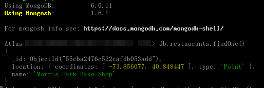
Ah, indeed, there is an _id field. Here is the actual output from my side:
> db.restaurants.findOne()
{
  _id: ObjectId("55cba2476c522cafdb053add"),
  location: { coordinates: [ -73.856077, 40.848447 ], type: 'Point' },
  name: 'Morris Park Bake Shop'
}
What I’m asking is that, in the sample data, it was:
"address":{"building":"1007","coord":
Yet the db.restaurants.findOne() is showing me totally different thing.
So if findOne() is not doing its own data massaging, then where the differences are coming from?
Or I am looking at the wrong collection?
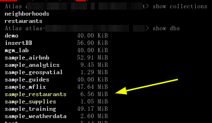
I was looking into the sample_restaurants collection in the MongoDB Atlas UI, where the mongoimport command in the tutorial didn’t specify a database…